This article appeared in the Spring/Summer edition of World Cruising Club Magazine
Cruising Southern Turkey’s Lycian Coast. Click on the link below to view the full article online.
A “Blue Voyage” on a Turkish gület along the Lycian Coast is more than worthy of its listing in 1000 Places to See Before You Die. Popular for it turquoise waters, Greco-Roman ruins, rugged landscape, sun drenched beaches and great food, we found that a few weeks meandering down this stretch of the Mediterranean Coast was a wonderful way to wind up our 7,000 mile cruising season on Moonshadow, which started in Thailand a the beginning of the year. Fairly protected from full force of the prevailing Aegean winds known as the Meltemi, and offering numerous marinas, municipal harbours and cozy anchorages, this stretch of Turkish coastline is a cruiser’s delight.
Marmaris 36º 51’ N 28º 16.7’ W
We spent a week in the Marmaris Netsel Marina, adjacent to the town, catching up on boat chores by day and enjoying the lively town by night. Netsel is a modern, full service marina with a variety of services on site, including an excellent supermarket, and a host of yachting related businesses within walking distance. We found the locals to be friendly, helpful and efficient, and in just a few days managed to trim down our “to do” and “to get” lists.
Situated at the head of a well-protected natural bay, the once-sleepy fishing village of Marmaris has exploded into a budget tourism mecca. A stroll through the town’s bazaar was truly a sensual delight, and at night we joined the crowds along the Haci Mustafa Sokak, also known as “Bar Street” where the doof-doof music pumping out of the nightclubs can be felt and heard all the way to the marina. But to enjoy the best of the Lycian coast, we headed for the quiet anchorages and small villages.
Turunç Bükü 36º 46.5’ N 28º 15.1’ W
Leaving the hustle and bustle of Marmaris town behind, we found anchorage in a small inlet called Turunç Bükü, just outside of the Bay of Marmaris. The beach was lined with holiday resorts, but we were relieved to have a quiet, if not a bit rolly evening away from the big city lights and all-night revelry.
Dalyan 36º 47.9’ N 28º 36’ W
The following day we motor-sailed east in light air and anchored behind Delicada (Dalyan) island just to seaward of the Dalyan River bar. When we arrived, the area was buzzing with day tripper and river boats, and the long brown-sand beach was crawling with sun worshippers. A local guide came by and offered us an all day tour of ruins at Kaunos, the town of Dalyan, the fresh water lake and some mud baths for US $200. We declined, figuring we might be able to do it ourselves in our dinghy. By sunset the place transformed into a ghost town and we were the only boat left.
The anchorage was not particularly well-protected but the meltemi had been quiet and we did have a relatively comfortable night, only rolling a bit after the sea breeze died and before the land breeze filled in from the opposite direction, keeping Moonshadow more or less in line with the gentle swell.
Setting off early the next morning in the dinghy, we dodged the Caretta caretta (loggerhead turtles) that were hanging out near one of their favourite nesting sites, Iztuzu Beach. We easily negotiated the shallow waters over the bar and made our way up into the Dalyan River delta. Inside the bar there was plenty of water and we found navigation through the wide reed-lined tributaries quite easy. The bright red Turkish flags flown high from the sterns of the local boats were visible above the reeds for quite some distance, giving us rough bearings to where we were headed.
Our first stop was at a fish farm blocking an entire tributary of the river. There was a small visitor’s dock to which we tied up. From there, it was a short walk to the ancient Roman city of Kaunos. In its heyday, Kaunos had many things going for it; a high hill for the fortification, a well protected harbour, fresh water from the river, timber from the pine trees growing on the surrounding hills and plenty of flat, fertile farm land. Historians speculate that Kaunos failed because the harbor silted, leaving it three kilometers inland, and because the inhabitants were plagued by malaria, which was evidenced by reports of the yellow cast of their skin.
The ancient amphitheatre was mostly intact, as were Roman baths, the agora (central square/market) and a few other buildings on the site. We decided to get a bit of exercise and hiked up to the ruin of the fort. The path was scarcely more than a goat track, unmarked and slippery with loose rock. At the top we were rewarded with a commanding 360º view of the marshland, the sea, and the picturesque village of Dalyan further inland. From this vantage point I made a mental map of how to make our way to town through the maze of tributaries and fish traps.
We made our way back down to sea level and wound our way by dinghy up to Dalyan. Just across the river from the village are some spectacular Lycian tombs carved into the face of the cliff. After a few photo ops, we continued upstream till the river opened up into a huge fresh water lake. A full throttle run gave our outboard a much needed flush out. We returned to Dalyan and enjoyed a traditional Turkish lunch on the riverfront, while gazing out at the tombs and turtles dodging the constant parade of tourist boats chugging up and down the river.
Ekinçik Limani 36º 49.5’ N 28º 33’ W
That afternoon a light Meltemi filled in and we decided not to tempt fate, so after our delightful day’s excursion, we moved north up the coast a few miles to a lovely and more protected anchorage in a bay called Ekinçik Limani. We found good holding in 17 meters, well away from the charter boats and gülets. The anchorage was very calm, quiet and well worth the four mile battery-charge run.
Fethiye Körfezi 36º 40’ N 28º 54.3’ W
A pleasant day’s sail in light airs took us to a large bay called Fethiye Körfezi about 20 miles southeast. This bay is a lovely cruising ground as there are numerous islands and a variety of picturesque, deeply indented coves providing fine shelter. It is also close to the charter hub of Göçek, and many of the coves were chocker with yachts and gülets. We found a very pretty, pleasant and uncrowded spot to anchor on the north side of a small privately-owned island called Domuz Ad, and tied our stern to an olive tree on the rocky shoreline.
Snorkeling in the warm, clear water I saw remnants of ancient amphora (a ceramic vase) embedded in the rocky bottom. After my last dive I surfaced to a loud racket. On shore was a donkey screeching as if to protest to my presence. The next day a French yacht tied up next to us and was also subjected to the verbal abuse of the disapproving donkey. I didn’t feel so bad.
Port Göçek Marina 36º 44.9’N 28º 56.5’ W
In need of a few provisions, we called into the Port Göçek Marina which is owned by Swissotel and run by Camper and Nicholsons. It is a first class marina with superb facilities, beautifully landscaped grounds and a host of amenities. Göçek is a friendly little village situated at the head of the bay, surrounded by pine forest inside a backdrop of mountain peaks. An impressive array of supermarkets, cafes, restaurants and chandleries are all within walking distance to the marina. No wonder it’s become a popular place to base a yacht or winter over.
Göçek is also the kind of village where weddings are a public affair. We visited on a weekend, so on both Friday and Saturday evenings we were treated to some wonderful live Turkish music which was part of two wedding celebrations. We walked into town on Saturday evening, and the whole village seemed to have come down to party and dance with the bride and groom at a small waterfront amphitheatre. On Sunday we shopped at the local market on the edge of town, about a 20 minute walk from the marina. In a large area shaded from the mid day sun by tarpaulins, there was a huge selection of house wares, hardware, clothes, toys, fresh produce, herbs and spices. The breads, local cheeses and olives were simply divine-perfect for provisioning!
Fethiye 36º 37.5’ N 29º 05.7’ W
With a good breeze, we sailed twelve miles south along the coast and anchored off the town of Fethiye within range of an unsecured wireless broadband signal from a nearby hotel. Fethiye, once the ancient town of Telmessus is situated at the foot of a pine tree covered mountain on the edge of a large but well protected bay. While most of the town’s buildings are Ottoman Empire or more recent architecture, there are still ruins of a Crusader castle on the hill above, with a few Lycian tombs carved into the solid rock faces of the cliffs just below.
On our first visit to town, we were greeted by a large and curious sea turtle basking near the quay where the fishing boats were tied. After a stroll around the town center, we were impressed by the friendliness of the people, the laid back bohemian vibe and low volume of tourism. Fethiye is the kind of place where a week can pass you by before you know it. It did for us. That night we returned to town for a meal out to celebrate Merima’s birthday and ended up on the pedestrian-only “bar street” sipping drinks, puffing on a nargileh (sheesha pipe) listening to some great music and chatting away with some friendly Turks at a convivial little joint called the Car Cemetery Bar.
There is quite a nice shopping bazaar in the middle of town, and on Tuesdays, there is a huge local market. In this part of the world, market day much is more than just a shopping trip. People come from villages and farms for miles around to buy, sell, eat, drink tea and mingle in a casual atmosphere. We found it a great place to stroll, people watch, check out the interesting items on offer, and pick up a few goodies.
One morning our daily walk took us to the head of the bay, where we had noticed a large ship yard building traditional wooden power boats and gülets. We were greeted by the manager of the yard and invited to have a look around. I counted no less than nine vessels under construction and a hundred craftsmen on site. All of the boats were being fabricated of exotic African hardwoods in the traditional fashion, strip-planks fastened to laminated ribs. With the exception of some small power tools, very little of the building process appears to have changed since the days of Noah. It was fascinating to see these boats in their various stages of completion, with craftsmen meticulously hand forming and fitting each piece. While the yard itself was about as basic as it gets, the end result, a spectacular gület which was just launched, was something to behold.
Departing Fethiye, the coast to the south is lined with rugged mountains plunging into the sea. We tried to find a spot just outside of Ölü Deniz (36º 32.9’ N 29º 06.8’ W), a magnificent land-locked lagoon about 15 miles from Fethiye. The area attracts a lot of tourists and the nearby anchorage was full, so we hovered around awhile checking out the beautiful beach and the dozens of para gliders descending from Mt. Baba, which towers 2000 meters above the lagoon. We later found a good calm spot to anchor behind a nearby island called Gemiler Adasi, which was covered in ancient ruins.
Gemiler Adasi 36º 33.4’ N 29º 03.9’ W
Gemiler anchorage was fine until late in the afternoon when it became a Grand Central Station for gülets. They were coming and going all through the night, revving engines, making lots of noise and dropping their anchor rodes over ours. A bit of swell started to work its way around the island late in the evening, so we departed the next morning as soon as our rode was clear.
In light air we motor-sailed south down a beautifully rugged stretch of coastline about 30 miles to the little town of Kalkan. From seaward we could see deep gorges slashing the mountain sides, cliffs pockmarked with caverns, sea caves and many areas of relatively recent rock fall, all evidence of Turkey’s geological activity.
Kalkan 36º 15.7’ N 29º 24.8’ W
Once a quiet little Greek fishing village, Kalkan has now been taken over by tourism. It still has a lovely charm about it, with plenty of nicely restored old Greek and Ottoman buildings, narrow cobbled lanes, and colourful splashes of bougainvillea. The harbor is small but well protected, and adjacent to town. Kalkan has a reputation for its very trendy shops, restaurants and cafes catering to upscale tourists and visiting yachties. We were fortunate to arrive by mid day and find space to med-moor. During the high summer season, the municipal harbour is chock-a-block with visiting yachts and usually full by happy hour. While we had a nice outlook facing the village, we were squashed in a “boat canyon” between a massive gület and a large charter yacht, with our fenders close to bursting. After two days we longed for a bit of privacy.
Kastellórizon, Mandraki Anchorage 36º 09’ N 29º 35.95’ W
A leisurely two-hour sail took us to a quiet anchorage off the desolate and rocky little isle of Kastellórizon. The easternmost of Greece’s Dodacanese island group, Kastellórizon the most distant island from Athens. While its nearest bit of homeland is Ródhos, about 70 nautical miles to the west, Kastellórizon lies just one mile off the coast of Turkey. The island has had a tumultuous past, but from all appearances it is once again on the rise, thanks to tourism. For this reason, the local officials turn a blind eye to visits by yachts cruising on a Turkish transit log, and allow them to anchor or tie up for a day or two and drop a few Euros into the local economy.
Kastellórizon’s attractive natural harbor is lined with stately and colourful Greek mansions surround by dry, rocky backdrop. It reminded us a bit of its charming Dodacanese cousins, Sými and Khálki. The biggest difference is that there were so few tourists that they went almost unnoticed. It is quiet, quaint and an ideal place to escape and forget about the real world for awhile. Arriving by yacht and med-mooring to the narrow quay, one can literally step off their pasarelle to a table at one of a half dozen or so little tavernas and cafes lining the narrow waterfront.
Opting for a bit of peace and quiet, we anchored just around the corner from the entrance harbor at a nice little anchorage called Mandraki. We took the dinghy ashore and found an old stone pathway that led around the edge of the castle-crowned hill to the village. Along the pathway there was a rather precarious stairway-no handrails-leading up to what it purportedly the only Lycian tomb in Greece, carved into the solid rock cliff face. This was our first opportunity to view one of these up close and examine the detail and the perfection of the carving of lines, angles and flat faces.
In the town of Kastellórizon many of the grand old buildings lay in ruin as a result of wars, earthquake and abandonment in times of misfortune. Drawn by the solitude or a desire to return to family roots, some have been lovingly restored as private homes or hotels, and quite a few more are work in progress.
The next morning, with the sun still low, we took the dink around to the southeast corner of the island where we found the Grotto of Perastá (approximate position 36º 07.4’N 29º 33.75’ W). We weren’t exactly sure of its location, but I was able to identify the opening from a photo in a tourist brochure. The entrance to the grotto is only about three meters wide and barely high enough for the dinghy outboard to clear the opening above. Driving in for the first time, we felt like we entered the mouth a whale ready to swallow us up. The small entrance leads into an immense room. Light reflecting through the water at the opening casts lovely dancing rays in various hues of blue on the cavern walls. As our eyes adjusted to the light, we could make out the silhouettes of the stalactites growing out of the ceiling above. Occasionally when a large swell would come into the grotto compressing the warm and humid air, the room would turn misty for an instant. The grotto of Perastá is very impressive, and worth the effort either with your own dinghy or by arranging a boat from town.
Later that morning we hiked up to the monastery of Ayíou Yeoryíou (St. George) toú Vounioú. Situated on a high plateau in the middle of the island, the complex dates back to the 16th century. The walk started behind the town, up a winding stone path and stairways. At the head of the cliff, the path straightened out and narrowed into a rough and rocky track bordering a goat pasture. George may have slain the dragon, but left the snakes, as we saw a few slithering into the cracks in the rocks as we approached.
Arriving at the monastery, we were disappointed to discover the main entrance was fenced in and locked up. Around the back however, there is a gaping hole in the wall through which we could walk into the main courtyard and check out some of the open rooms and crumbling structures. In typical Greek fashion, while all ancillary buildings were crumbling around it, the Orthodox chapel was in good nik. A peek in the window confirmed that it was quite well maintained and the locked door had protected all the religious artifacts inside.
It was a clear and calm morning and the walk back to sea level rewarded us with outstanding panoramic views of the harbor and village, the Turkish mainland and surrounding islets.
Kaş 36º 11.8’ N 29º 38.4’ W
The next morning we made the short trip across to mainland Turkey and the town of Kaş. The meltemi had been at rest for a few days, and Kaş Limani (bay) was exceptionally calm. Instead of going into the municipal harbor and being jammed in with other yachts like keys on a piano, we anchored Moonshadow in the bay just outside the harbor and took a long stern line around a rock on the breakwater, keeping our bow pointed into the gentle swell.
Kaş is a lovely little holiday town with a central area jammed with shops, galleries, cafes bars and restaurants. A large and very intact ancient amphitheater overlooks the bay and in the high cliffs behind the town are a number of Lycian tombs which are attractively illuminated at night. The actual top of the mountain is shaped like an alien space man lying on his right side. On Fridays there is an excellent fresh produce market on the edge of town under awnings stretched between the trees in an old olive orchard. We came back with big bags of excellent fruits and veggies costing just one to two New Turkish Lira (US $ .70-$1.40) each.
We arrived just after the start of the Muslim holy month of Ramadan. During Ramadan, Muslims, if they are able, abstain from food and drink during daylight hours as a show of empathy for those less fortunate. In some places they actually fire gun shots or light off fireworks to wake people up early enough to eat breakfast before the Morning Prayer at sunrise, and again after sunset to let people know that they can tuck into their evening feast. While we enjoyed listening to the “call to prayer,” the gunshots took us a bit of getting used to.
Üçağiz Limani 36º 11.7’ N 29º 51.1’ W
Further down the coast we stopped in a lovely little area collectively known as Kekova. The Island of Kekova is long and narrow, lying just off the coast, protecting a stretch of coastline and a number of charming little bays. We anchored in the calm and shallow Üçagiz Limani (Bay) near a small fishing village with the same name. The mainland and islands around Kekova area are dotted with ancient ruins and sarcophagi.
We headed ashore for a stroll around the village of Üçagiz. While it is touted as an unspoiled fishing village, most of the restaurants that dominate the waterfront have sprouted long, rickety and rather tacky looking jetties that are meant to attract yachts and gülets to their dining tables with offers of free water, electricity and Internet. The village itself was nondescript, but is situated on the site of the ancient city of Teimiussa. We enjoyed an afternoon exploring the interesting ruins on the east end of the town over looking the bay.
Early the next morning, before the tourist boats had arrived, we took the dink across the bay to the hamlet of Kaleköy (36º 11.2’N 29º 51.6’ W). Kaleköy sits on the ancient city of Simena, part of which rests a few meters underwater thanks to a major earthquake a couple millennia ago. One can still see building foundations and a sarcophagus just above and below the crystal clear water, particularly with a mask and snorkel.
Kaleköy cascades down a steep hillside to the sea from a small but attractive castle which is a remnant of the Crusades. While it also has restaurants with jetties, they have done a better job with the aesthetics than their neighbors across the bay. We had a nice walk through the rocky paths of the village up to the castle where we enjoyed the commanding views of the bays, islands and surrounding countryside. One of the interesting features of the castle was its rather petite amphitheatre, with seating for perhaps 100, carved entirely out of the face of the stone hillside. I’m not sure if it was because it was early in the day or late in the season, but we had the entire place to ourselves.
Most of the homes in Kaleköy appear to be very old and are built of stone with terracotta tile roofs. Colorful flowers, basil and oregano growing on or around many of the cottages add to the charm. Dotting the rocky hillside are thousand-year-old olive trees, with wildly contorted trunks, that are still yielding fruit. The locals were very friendly and one young Turkish girl selling pareos attached herself to us, acting as our tour guide and telling us a bit of the local history in her excellent English.
Setur Finike Marina, Finike 36º 17.6’ N 30º 09’ W
The next morning we lifted the anchor for the last time of the season. We motor-sailed in light breezes and flat waters the last 18 miles to Finike, a small farm town that is barely given a mention in the Lonely Planet. Many yachties choose to winter over or leave their boats here due to its mild climate, laid back atmosphere and reasonable berthing fees.
As we approached the Setur Finike Marina, we felt the first few raindrops in many months, reminding us that winter was approaching and it was time for us to head home to New Zealand for the southern Hemisphere summer.
Officialdom
Turkey has numerous ports of entry along its coast and is most welcoming to foreign yachts. Check in/out is an easy and straightforward process. One must visit the Port Authority, Customs, Immigration and Quarantine, all in a prescribed order. All the information you need to check in/out should be provided by the marina. We found all the officials to be friendly, helpful and professional. A three month visa-on-arrival is granted free to most nationalities, but some nationalities, such as U.S. citizens, may be required to purchase a visa stamp for €15. Visiting yachts will be issued a transit log good for six months, which may be renewed, and it surrendered upon departure. Foreign vessels may remain in Turkey for up to five years. Check-in is not required at each port visited, but most marinas or municipal harbours will request to see your transit log and passports.
Pilotage
Cruising Guide-Turkish Waters Pilot by Imray
For current information on ports of entry, formalities and other cruising related information, visit Jimmy Cornell’s web site www.noonsite.com.
Charts: C-Map CM93 is adequate but does have numerous inaccuracies. Always supplement electronic charting with up-to-date paper charts, a depth sounder and a good set of eyes.
Weather: We used a combination GRIB files from SailMail, daily reports broadcast on the Mediterranean Cruisers Net, Olympia Radio (Greece) who broadcast regular maritime forecasts on SSB (see Turkish Waters Pilot for schedules and frequencies), and of course, personal observation.
Tourism
Lonely Planet guides for Turkey and Greece.
Currency
The official currency is the New Turkish Lira, or YTL. ATM’s are available in tourist areas, and most merchants accept credit cards. The Euro is widely accepted.
Communications
Internet is widely available, and most marinas have wireless broadband available. Many cafes offer free broadband to patrons. Cell phone coverage is excellent, but expensive if you are roaming. If you plan to spend more than a few weeks in Turkey, you can get a local SIM card for your phone, but you must register it with the Turkish Government in Ankara. Most cellular service providers will fill out all the required paperwork, but you must bring your passport when making the application.
About the Author
George Backhus was born and raised in the San Francisco Bay Area. As a teenager he followed the travels of sailor Robin Lee Graham, the youngest person at the time to sail solo around the world. Graham’s regular articles appearing in National Geographic magazine inspired George’s dream of some day sailing the world and visiting far away places.
He purchased his first yacht in 1981 and spent much of his free time sailing and racing on the San Francisco Bay. Honing his sailing skills over the next ten years, George eventually earned a U.S. Coast Guard Master’s Licence and worked part-time as a sailing instructor at a leading Bay Area sailing club.
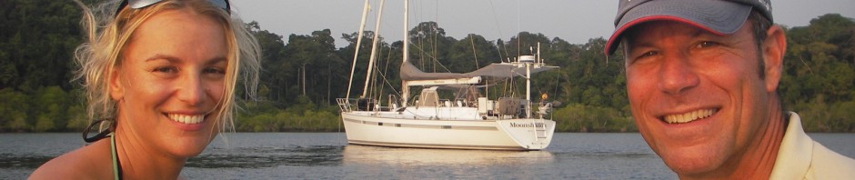
George “punched out” of a successful marketing career in corporate America in 1994, purchased Moonshadow, a Deerfoot 62 cutter, and set out in pursuit of his lifelong dream. Along the way, he began writing newsletters to friends and family back home, describing the amazing places he visited, his incredible experiences and the unique cruising lifestyle. Now 14 years into his planned five-year circumnavigation, he has sailed more than 60,000 miles and visited 30 countries, and taken up permanent residency in New Zealand along the way. He has written numerous articles that have appeared in the popular Northern California Sailing Magazine Latitude 38, and his bi-monthly “sailor’s logs” appear in the highly respected cruising web site SetSail.com.
George’s Kiwi partner Merima joined him on the voyage in 2005. They spent two years cruising Australia and Southeast Asia before heading to the Med via the Indian Ocean and Red Sea. They plan to spend a couple more years cruising the Med before heading across the Atlantic in the ARC Rally, closing the loop on their circumnavigation. Moonshadow is not new to the ARC. She sailed in the inaugural event in 1986, and was the first monohull to finish.
In addition to bluewater cruising and yacht racing, George is an avid SCUBA diver and spear fisherman. He and Merima enjoy travel, hiking, attending musical and cultural events, reading, cooking, wine and international cuisine