Isle of Pines

Bonjour!

We’re anchored in beautiful Oro Bay on the northeastern side of the Ile des Pins (Isle of Pines). A low pressure system passing to our southwest has given us our first bit of weather since we arrived in New Caledonia. It’s overcast, warm and humid, with occasional drizzle and winds from 6 to 26 knots. Not particularly nasty, but not great for any shoreside soujourns.

Tim and I have been doing a bit of spearfishing on some of the coral bommies in the bay. There are plenty of edibles here-cod, hump-headed wrasse, grunt, and our favorite, coral trout. BIG coral trout! They spook easily, quickly retreating to the safety of a puka in the base of one of the bommies at the slightest sound we may make. When they come out to play, it seems that one of two rather large and toothy white-tip reef sharks is within eyeshot. Bugger! In addition to the edibles, there are plenty of beautiful colored tropical fish, giant clams, turtles and even a small lobster or two.

Our landfall to the Ile des Pins was Kuto Bay, on the southwest side of the island. Kuto is a shallow, protected bay with a long, crescent-shaped beach with sand the color and consistency of confectioner’s sugar. The shore is lined with pine and palm trees. It’s very quiet, and the biggest excitement seems to be the daily arrival of the ferry from Noumea.

While in Kuto Bay, we were host to some squatting remora that seemed to think that the bottom of “Moonshadow” was the underbelly of a basking whale. They hung out, and on, for two days, and seemed to enjoy the little bits and pieces of food, etc. that came their way via our through-hull fittings.

Shoreside, a one kilometer walk up the main road led us to two very significant Ile des Pins landmarks. First, on the right, was the ruin of a prison that was home for French revolutionarys in the late 1800’s and early 1900’s. It looked to be a dreadful place. Some of the cells were so small, the walls between them were wider.

The other landmark, across the road, is the boulangerie, ubiquitous in French parts of the world. Of course, we loaded up on fresh baked croissants and baguettes. One baguette always seems to go missing on the way back to the boat. Hmmmmm.

The charting of most of the Ile des Pins is very poor and incomplete. Since much of the water is protected by barrier reefs, we were able to take a long dinghy ride to scout out an anchorage on the south end of the island. The following day, we moved five miles southeast to Port de Vao.

From our anchorage, we were able to visit Vao, the main village of the island. The bustling metropolis of Vao boasts a huge Catholic church, two schools, a small medical center, the government center for the island, a post office, a general store and perhaps a few dozen homes.

After taking in all the hot spots in Vao, we took the dink up into the estuary between Port de Vao and Baie d’Upi. Located on the shore is one of the last boat yards specializing in the construction of outrigger sailing canoes. Numerous canoes are moored along the shoreline. The main hulls are dug out of a single, huge log and with the exception of Dacron sails, they appear to be authentic versions of boats used by the Melanesians for thousands of years.

Looking to do a bit of diving, we hopped over to Ilot Brosse, three miles to the southwest. Although the island was quite attractive, with a grove of pines and a gorgeous white-sand beach, the diving was marginal. The coral was covered in algae and there were few fish to be seen. The weather was packing in, so we returned to the protection of Kuto Bay.

There are two nice walks that can be enjoyed from Kuto Bay. Our first stroll was to the top of Pic Nga, the highest point on the island at 262 meters. It was a rather easy walk on a good trail, and from the top, one can see the entire island and surrounding reefs, as well as much of Grand Terre, the main island, lying 70 miles to the northwest. It was well worth the exercise and provided some great Kodak moments.

The following day, we walked around the perimeter of the Kuto Peninsula, through the pine and native bush forest, along the raised coral shoreline. In some places, it appears as if the trees grow out of solid coral! The sea has eroded the uplifted coral at sea level, leaving dramatic overhangs above.

The break in the weather that allowed us to move over to Oro Bay was short lived. We’re rocking and rolling, and collecting rainwater. It looks like we’ll just sit out this system in this gorgeous spot, and enjoy a bit of reading, writing, snorkeling and cooking.


Posted in All Cruising Logs, New Caledonia, Pacific Ocean Logs, South Pacific Logs | Comments Off on Isle of Pines

Snug in Noumea

Bonjour!

We arrived safely in Noumea this morning at 1030 hrs and are snug in the marina at Port Moselle.

After pleasant visits from New Caledonia Quarantine, Customs and Immigration, we spent the day tidying up “Moonshadow.”

Its time for a shower and then to pop the cork on the champagne that’s cooling in the fridge. We’re all up for dinner out on shore and a night of uninterrupted sleep.

We plan to enjoy a few days of “city life” here in Noumea and then head south to the Isle of Pines.


Posted in All Cruising Logs, Pacific Ocean Logs, South Pacific Logs | Comments Off on Snug in Noumea

Lord Howe to Noumea, Day 4

Last night was interesting aboard “Moonshadow.” “Interesting” usually means no sleep for me and last night was no exception.

A cold front began passing over us, bringing lots of wacky wind shifts, dramatic changes in wind speed, squalls and the odd “sparkler” or lightning flash in the clouds. This always makes for challenging sailing, especially at night when visibility is already poor and it is very easy to become disoriented. Twice when the squalls hit we hove to, or parked the boat with the sails up, while the wind did it’s convulsive routine and the heavens opened up with rain. It was sort of like running through Nature’s Coral Sea Yacht Wash-pounding rain, driving wind, zero visibilty. The only thing missing was the $25 bill and free cappucino while you wait. “Moonshadow” was sparkling clean this morning, the salt, grime and fish scales washed away by the water blast.

After three good drenchings in the middle of the night, the winds finally backed around to the west and we began sailing a course directly toward the pass entrance to Noumea in the lumpy seas left over from the noreasterly. The breeze steadily dropped off and once again we are motorsailing, albeit in a gentle swell and clear, sunny skies.

Tim and I were reflecting on the huge mahi he caught yesterday. Tim commented when he was reeling this monster in, the drag in the reel was getting hot! Mahi do an interesting chameleon act. In the water, they have an irridescent blue color. When they come out of the water, they change to a greenish gold color. This is why the Mexicans call them “dorado,” meaning “golden.” When they die, they turn silver, as if their soul has left their body. A few minutes later, they return to their green-gold color. At the end of the day, they taste great.

As of this writing, our postition was 24 deg. 15 min. south by 164 deg. 32 min. east, or 149 miles southwest of the reef pass entry to Noumea and a stone’s throw from the Tropic of Capricorn (23 deg. 27 min. south) Given our present course and speed, we should arrive at the pass just after sunrise tomorrow morning (good timing!) and be at the Customs dock in Port Moselle about two hours later.

Champagne is cooling.


Posted in All Cruising Logs, Pacific Ocean Logs, South Pacific Logs | Comments Off on Lord Howe to Noumea, Day 4

Lord Howe to Noumea, Day 3

The wind has finally arrived! Just after midnight last night, the breeze picked up to about eight knots so we were able to give the diesel a rest after more than 30 hours of motorsailing. Of course the wind is from the direction that we are headed, northeast, but what the heck, it’s free and it’s quieter than the motor.

The wind has gradually picked up to about the 15 knot mark so we are making about seven knots on a heading of magnetic north. Our position at this writing is 25 deg. 57 min. south by 163 deg. 11 min east, or 273 miles southwest of Noumea.

While it hasn’t been the most comfortable day, its warm and the fishing has been great. We boarded a 50 pound mahi-mahi just after finishing the last one caught for lunch. Yeeehaaaaa! With the freezer full, we’ve had to give the fishing rig a rest for now.

Cate and Tim have gotten into a keen chess competition and I have dived into an old James Clavell novel.

All is well on board and we anticipate another day and a half to two days to Noumea.


Posted in All Cruising Logs, Pacific Ocean Logs, South Pacific Logs | Comments Off on Lord Howe to Noumea, Day 3

Lord Howe to Noumea, Day 2

Greetings from the Coral Sea!

We finally broke our fishing curse today with the landing of a small mahi-mahi this afternoon. Yea, fish for dinner! There seems to be a direct relationship between pulling some frozen chicken breasts out of the freezer and catching fish. The fish wins and the chuk will have to wait for its turn on the barbie till tomorrow.

While the sea Gods have been blessing us with a gentle ride, Aeolus, the Wind God, has been conspicuously absent on this passage. The five-to-ten knot breeze we had yesterday faded last evening and we have had light and variable winds, below three knots all day. This is great for fishing, cooking and sleeping, but lousy for sailing. The cast iron jib is humming away and has been pushing us along at about 7.5 knots all day.

Mostly clear skies and a nearly full moon have made the night watches a breeze. There is nearly enough reflected light to read without the lights on at night. Not that there has been much to see on this passage. Most of the sea birds left us near Lord Howe. The only other thing we’ve seen so far is a couple of whale spouts on the horizon.

In our first 24 hours after departing Lord Howe, we made 200 miles toward Noumea. As of 1500 hours (Noumea time) we were at 25 deg. 18 min. South by 162 deg. 10 min. East. or roughly 430 miles southwest of New Caledonia.

The weather gurus think that we will get a bit of wind starting tomorrow. We hope so as we may be a bit close on diesel to motorsail the entire trip. We’ll see.

Posted in All Cruising Logs, Pacific Ocean Logs, South Pacific Logs | Comments Off on Lord Howe to Noumea, Day 2

A Week on Lord Howe Island

A Visit to Lord Howe Island

Well off the beaten “Coconut Milk Run” track, I think that Lord Howe Island may well be one of the best-kept secrets in the South Pacific. Located 225 nm Northeast of Sydney and 675 nm Southwest of Noumea, New Caledonia, this ruggedly beautiful island sees relatively few foreign cruisers.

On our second morning out of Sydney, I had the 3 am to 6 am watch. It’s always my favorite, as I love to watch sunrise and the start of the new day. On this particular morning, there was a line of small clouds on the horizon, illuminated by the first light. The sun’s light appeared yellowish orange, and the bases of the clouds a lovely coral pink. What at first appeared to me to be a to be a couple of larger clouds on the horizon gradually became more clearly defined. The sun was rising directly behind the dramatic 2000+ foot peaks of Mounts Lidgbird and Gower, on the south end of Lord Howe Island. We were still 45 nm southwest the island. Shortly afterward, Ball’s Pyramid, the spectacular 1800-foot, solid rock pinnacle lying 13 miles south of Lord Howe, also appeared on the horizon. Mornings like this are what make cruising “priceless.”

Motor-sailing in a light sou’wester, we arrived at the entrance of the lagoon by mid-morning. It was a perfect time to make landfall, as the sun was high enough and more or less behind us. The conditions were ideal for negotiating a shallow reef pass.

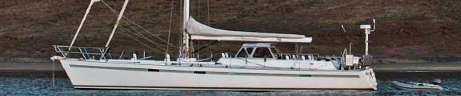
We contacted Clive Wilson, who looks after yachts visiting Lord Howe, on VHF channel 12. He’s a native of Lord Howe and knows the back of his hand nearly as well as the bottom-ography of the lagoon. Clive met us at the pass entrance in his sturdy launch and gave us precise bearings through the narrow Erscotts Passage into the lagoon and led us to one of the very beefy guest moorings just south of Rabbit Island. Lord Howe is World Heritage listed and is the site of the southernmost coral reef in the world. Anchoring in the lagoon is not permitted and the use of a mooring is obligatory.

Charts of the lagoon are questionable. Entering or leaving the lagoon at night is not advisable. The track plotted by our chart plotter showed us as having coming in right over a shallow coral reef awash in surf! While we had heard and read that the Lagoon can be quite rolly, but the breeze sea state were slight for the five days we were there and we found it quite calm except for a tiny bit of motion at high tide.

After lunch, Cate, Tim and I splashed the dink and headed ashore for some exploring. Landing was easy on a lovely white sand beach just off “the Settlement,” which lies on a gentle west-facing slope at the northern middle of the island. The hub of the Settlement consists of a post office/espresso café, a diesel powered electrical generation plant, the town hall, a couple of boutiques and a general store/fish and chip shop.

It is apparent that the locals take a great deal of pride in their island. Everything appeared tidy and well manicured. Much of the island looks like a park or botanical garden. We found the locals to be friendly, helpful and laid back.

The primary form of transportation on the island is bicycle. Given that there are only about five miles of road, one would need a pretty compelling reason to own a motor vehicle. As in days past, car doors were left unlocked and keys in the ignition. At every point of interest there was a bike rack. Locks aren’t necessary, and you can just leave the helmet in the basket. No worries!

We rented some sturdy 5-speed mountain bikes at Wilson’s Rentals (Clive’s son) for about $3 US a day. Cycling on the island is easy and pleasant except that it can be very dark at night, and there are few streetlights. B.Y.O. flashlight!

Lord Howe has no indigenous peoples. It was first populated in the early 1800’s as a whaling station, providing fresh water and provisions to passing ships. Many of the 350 current residents are directly descended from the first six settlers. Today, the two main industries are tourism and exportation of Kentia palm seeds, which are shipped worldwide and grown as an ornamental plant. As a tourist destination, it has a great deal to offer.

Only two to three hours’ flight from the east coast of Australia, it has almost all the exotic beauty of the islands of Bora Bora and the Marquesas. One can find pleasant weather, excellent diving, hiking, game fishing, surfing, white sand beaches, a golf course, luxury boutique type accommodations, and fine dining, yet still feel well out of reach from civilization.

What you won’t find at Lord Howe are some of the negative aspects of French Polynesia and some of the other South Pacific islands. The governing board of Lord Howe strictly limits the number of tourist beds to 392, so there is no hype, over development or throngs of tourists. The nearest timeshare salesperson is at least 500 miles away. There appear to be no tribal disputes, crime, pollution, litter, graffiti, poverty or exorbitant prices. Only full–time residents are permitted to own real estate and build homes, so it’s unlikely that it will ever become an exclusive enclave of the rich and famous.

There are miles of hiking trails on the island offering all types of terrain and scenery. Free maps are available and the trails are well marked. We warmed up on Wednesday by hiking up to the cliffs along the north end of the island. In addition to excellent views of the reef in the clear blue waters directly below, we had a spectacular vista of the entire island, the Lagoon, and, of course, the two large peaks towering at the south end of the island.

Each Wednesday afternoon at the Town Hall, there is a showing of “historic films” about Lord Howe Island. The calendar was wide open so we attended. The local “medical officer” showed three short travel log type films made in the forties, fifties and sixties. It is quite interesting to note how little the island has actually changed from the days of being serviced by the Qantas “flying boats,” which landed in the lagoon. Some parts were a bit corny, but entertaining nonetheless.

The following day, starting at 0730, we went on an organized hike led by Jack, a local tour guide. The “walk” was a four-and-a-half mile journey to the top of Mount Gower. At 2840 feet, it is the tallest peak on the island. This was Jack’s 633rd trip to the top, so he knew the way pretty well, and had a “no big deal” attitude that was calming for us newbies. Jack’s father and grandfather both led groups to the top of the mountain before him.

The walk started as a stroll down a dirt road and then graduated to helmet-clad, white-knuckled hand over hand, rope assisted climbing up near-vertical rock walls and traversing cliff-hanging trails that were not much wider than a DD hiking boot. The cracks in the rocks and the dense root structure of the plants clinging to the side of the mountain made for a pretty good natural ladder, but the frequent showers from the previous few days also made the bare spots as slippery as snot. My acrophobia had me desperately clinging to the guide ropes on the steep parts of the ascent.

The vegetation varied from grassy fields to low scrub to palm forest to dense rain forest. All was quite natural and beautiful. Migrant sea birds were plentiful. At one point, Jack put out a call, and dozens of providence petrels literally dropped out of the sky all around us. These birds were definitely built for flying, as their landings were more like a semi-controlled crash. A few became caught in the trees and bushes before making their way to terra firma, where they awkwardly hobbled along on their tiny webbed feet. Ironically, they nest in underground burrows.

These birds seem to have no fear of humans. They came right up to us, ate out of our hands and even allowed us to pick them up and pet them. While they were friendly, they were not quiet. In the air or on the ground, they screeched loudly and endlessly. We were happy to be out of their cacophonous company in short order.

Equally as friendly and fearless were the wood hens. They appeared from time to time along the trail and a pair of them joined us for lunch at the top, happy to quietly eat bread crust from our hands. Because they are flightless, meaty and slow moving, they nearly became extinct at the hands of visiting sailors looking for a fresh alternative to salt beef. Today they are increasing in numbers, much to the chagrin of the locals, whose gardens they like to feed from. Talk about the tables turning!

Jack led the group of 15 hikers at an easy pace, stopping frequently for rest stops. While we were catching our breath, Jack explained to us in detail about the wide variety of flora and fauna on the mountain with the knowledge of a university professor. As we were climbing, the top of the mountain looming above us seemed an impossible goal, but by mid-day, we were at the top, on level ground, enjoying our accomplishment, a spectacular view and our well-deserved picnic lunches.

The climb to the top had bolstered our confidence a bit, so the descent was less of a vertigo inducing affair. Tired, blistered, sore but satisfied, we arrived back at our sea level starting point at 1630, all safe and sound. It was back to the Moonshadow for us, to wash off the head to toe coating of mud.

We rewarded ourselves that evening with a lovely dinner ashore at one of the cool little restaurants. Clive Wilson was kind enough to ferry us to and from the beach so we didn’t have to cycle or walk in the dark. It was an early evening for the crew of Moonshadow.

Lord Howe has a 2600-foot airstrip with an adjacent Australian Bureau of Meteorology station. We popped into the BOM station to pick up some weather information and Nigel, the local meteorologist, was happy to give us weather information as well as a tour. We also arrived in time to view one of the four daily releases of a weather balloon.

We watched while Nigel attached an electronic instrument module to a three foot diameter, hydrogen filled balloon. He then took it outside, released it and aimed a radar-tracking device at the balloon. Inside the station, information such as temperature, dew point, barometric pressure, wind speed and direction, and cloud height was being recorded on a computer. All this data would be sent to Sydney for compilation and subsequent forecasting by the weather gurus.

Our favorite weather guru, Bob McDavitt from Met Service New Zealand sent us an email indicating that two lows were brewing in the Tasman Sea and that it would be a good time to leave Lord Howe and head for Noumea. We said our goodbyes and made Moonshadow ready to head back to sea.

The following morning at 0700, Clive Wilson, from a vantage point on shore, once again gave us precise bearings to guide us safely through the pass and into deep water.

With New Caledonia ahead of us, we spent most of the day watching Lord Howe Island slowly disappear behind us. Hopefully, we will have the opportunity to visit there again some day.

Posted in All Cruising Logs, Australia Logs, Pacific Ocean Logs, South Pacific Logs | Comments Off on A Week on Lord Howe Island

Departing Lord Howe for Noumea

We departed Lord Howe Island, bound for Noumea, New Caledonia, at first light this morning. At this writing, our position was 30 degrees 58 minutes South by 159 degrees 37 minutes West, or about 45 miles northeast of Lord Howe, and 640 miles southwest of Noumea. It is a spectacular, warm and sunny, crystal clear day. The two peaks of Lord Howe are still visible off our stern.

We enjoyed five unbelievable days at Lord Howe. Lord Howe has all the ingredients of paradise-dramatic geography, lush vegetation, abundant wildlife, comfortable climate, crystal clear waters, white sand beaches, friendly people and just the right dose of civilization. Unlike many South Pacific Islands, it is not plagued with litter, pollution, crime, third-world beaurocracy, overdevelopment, lack of amenities, throngs of tourists or high prices. I would personally rate it “best so far” of all the remote islands we’ve visited, but don’t tell anyone. Lord Howe is a unique gem of a place-I’ll write more and send it off when I can collect a few thoughts and develop my photos.

Cate and I are both a bit sore from a long walk we took on Thursday. Tim, being the fit, young surfer stud he is, has taken it all in stride. Our walk was actually a 14 kilometer round trip to the top of 2700-foot Mt. Gower. It was actually more of a climb, as about 25% of the ascent/descent was done with ropes on near vertical terrain. It was quite a beautiful and memorable experience to be on top of such a spectacular peak.

The good news is that we have nice weather today. The bad news is that it is just a bit too nice. We have been motorsailing all day in five to ten knots of southerly breeze and meter to meter-and-a-half seas. It’s easy going, but would be nice to sail instead of burning up loads of dinosaur juice. We’re getting a nice bit of current push and have been averaging 8.5 knots over the ground, while making a bit of extra easting in anticipation of easterly trade winds filling in as we move into the tropics.

We’ve been passing the day by munching, reading and listening to lots of good ‘ol rock and roll on the sound system.


Posted in All Cruising Logs, Australia Logs, New Caledonia, Pacific Ocean Logs, South Pacific Logs | Comments Off on Departing Lord Howe for Noumea

Lord Howe Island

The sun rising behind Lord Howe Island’s dramatic peaks was quite a sight this morning. I spotted Mts. Lidgbird and Gower from more than 40 miles off at about 0500. These two dramatic 2000+ foot peaks are as impressive as anything we’ve seen in the South Pacific.

As the sun rose and we motorsailed closer in the light breeze, we could see the rest of Lord Howe Island, as well as Ball’s Pyramid, a single pointed rock jutting out of the ocean, about 13 miles south of Lord Howe. All in all, it was a beautiful morning, accentuated by a spectacular and exotic landfall. (Piccies will follow)

We were met at the southern entrance to The Lagoon by Clive Wilson and his grandson in a sturdy looking twin-engine launch. Clive must know the “bottom-ography” of the waters around Lord Howe like the back of his hand. He guided us through the shallow pass with a series of turns until we were through the reefs awash in the southwest swell. With depth nary a foot or two deeper than “Moonshadow’s” keel, the “pucker factor” was high.

We anchored for a couple of hours just inside the pass, awaiting the high tide when Clive returned from a bit of fishing with his granson. He then led us to a mooring area near the center of The Lagoon and closer to “town.” With depths showing just inches under our keel, the pucker factor was raised a notch or two. Our faith in Clive was warranted, as we didn’t touch the sand and coral bottom and made it safely to a very heavy duty mooring inside the protection of the barrier reef.

The island itself is quite lush, completely covered in a variety of greenery ranging from grass to eucalypt bush and palm trees to Norfolk Island pines.

With beaches, hiking trails and the world’s southernmost coral reef, there is plenty to see and do here. Tim pulled out his surfboard and waxed it up in anticipation of a strong sou-westerly that should bring some nice waves tomorrow. We plan to spend at least a few days exploring the island, depending on the arrival of weather that will suit our passage northeast to Noumea.


Posted in All Cruising Logs, Australia Logs, Pacific Ocean Logs, South Pacific Logs | Comments Off on Lord Howe Island

Sydney to Lord Howe Island

After six months of being “dock potatoes,” doing just a bit of coastal and harbor cruising, it’s taking us awhile to get our sea legs.

The good news is that the sailing has been fast and easy and Moonshadow has been pretty much looking after herself. In the first 24 hours after leaving Sydney, we effortlessly covered 210 miles, just about half the distance to Lord Howe Island.

Over the course of a beautiful, warm, sunny day, the wind has slowly eased and in the early evening we found ourself motorsailing in eight knots of breeze. At this rate, we should make landfall at Lord Howe some time late tomorrow morning, with the sun high enough to help us see our way in through the reef pass into the lagoon.

The day has been uneventful-bland meals, easy sailing, a variety of sea birds, lots of naps and NO FISH! The only thing close was a small squid that had washed up on deck this morning. MaiTai turned her nose up to it and looked at us as if to demand a fresh tuna or mahi. Our new fishing outfit is still a virgin!

Our 2000 hours local time position was 32 degrees 14.6 minutes south latitude by 157 degrees 00.8 minues east longitude.

Posted in All Cruising Logs, Australia Logs, Pacific Ocean Logs, South Pacific Logs | Comments Off on Sydney to Lord Howe Island

So Long to Sydney

Gidday!

It was crisp and clear this morning as we motorsailed out of the Sydney Heads, destined for Lord Howe Island, about 420 miles northeast. A ferry penguin noisily chased us as if to say a final goodbye to the “Moonshadow” from Sydney.

One of the few bad things about cruising is moving on and saying goodbye to all the friends we make along the way. We were especially fond of Sydney, and made lots of friends in addition to people whom we already knew who have migrated there.

Last night, tired after our final day of preparation, we attended a small get-together on Millenium USA to say “so long” to all our cruising friends in the marina who are either hanging around or heading for different destinations. We also had visits by Cate’s brother Matt, good friend Trish and my college fraternity brother Rob Salisbury. It’s always bitterweet to have to say goodbye to good friends and family, but exciting to be on the move again and headed back to all the beauty and tranquility of the tropical islands in the South Pacific.

After about a half-hour of motorsailing, the breeze picked up and we have been sailing in a cool 10 to 15 southerly knot breeze just forward of the beam, averaging better than eight knots of boatspeed all day. The seas, lumpy along the New South Wales coastline have been calming down a bit, making it easier to get our sea legs (and paws).

In addtion to Cate, MaiTai and I, our crew for the trip is Tim Prior, a friend and frequent crew aboard “Bossanova.” Tim is a marine biologist, surfer, and season traveler.

As of this writing, we were approximately 150 miles northeast of Sydney in very good sailing conditions. We had a “swim by” earlier today from a pod of very large dolphins who choreographed a couple of nice synchronized jumps in our bow wake.

With a waxing moon, lots of bioluminescence in the water and a bright display of stars, sailing at night just doesn’t get much better.


Posted in All Cruising Logs, Australia Logs, Pacific Ocean Logs, South Pacific Logs | Comments Off on So Long to Sydney