One of our major goals this season was to visit the Banks and Torres, two remote island groups at the very northern end of the Vanuatu chain. We had read and heard tales from other cruisers about spectacular and uncrowded anchorages, beautiful volcanic islands, primitive villages, excellent diving and plentiful lobster and coconut crab. Any one of these would be reason enough to go!
We needed to provision up in Santo for at least a month of life without any restaurants or grocery stores. Provisioning in Santo is adequate by South Pacific standards, but “not exactly” like Australia or New Zealand. There are a plethora of small Chinese stores in town, each having a broad and slightly different product mix, ranging from food to clothes to hardware and lots of junk, but none seems to have all that we need. Shopping here is more like a scavenger hunt. To complete our meager list, it was necessary to visit a dozen stores, and then, of course, the open market for fruits and veggies. Due to the hurricanes earlier this year, the fruit crop is thin. The market was more like “roots and veggies.” We still got skunked on a few tough items like pancake syrup and butter.
We also needed diesel, and unfortunately, there is no marina or fuel dock in Santo. Reinforced trade winds blowing straight into Segond Channel from the east made it unsafe for us to bring Moonshadow along side any of the big concrete commercial wharves for fueling. We had to arrange a tank truck to bring a load of diesel to a badly deteriorated bulkhead at an old, abandoned fish processing plant in the nearby and well-protected Palikulo Bay. With tank truck adjacent to boat, we siphoned the diesel into our tanks. I had plenty of practice at this in Mexico, and the whole operation went better than planned-no scratches and no spills. We were set to go.
The weather Gods got angry and threatened a strong northerly. We returned to Santo to wait it out and catch up with some friends. After two days of not much of anything, the southeast trades returned and we set sail heading north with a plan to dayhop our way all the way to the Torres Islands.
We are now lying anchored in a lovely spot named Lonakwarenga Bay, on the Island of Tegua in the Torres after spending five nights in as many different anchorages along the way. Here are a few highlights of our trip.
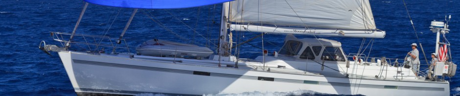
Leg one was an easy forty-mile motor-sail in light winds along the East coast of Espiritu Santo to Port Olry, near the northeast corner of the island. We anchored in the lee of a small coral island called Thion, which protects the rickety logging village of Port Olry from much of the wind and swell of the southeast trades. With a rocky islet In the middle of the anchorage, white sand beaches and green hills in the background, the scenery is quite alluring. The calm anchorage afforded us a good night’s sleep.
Early the next morning, we departed for Gaua Island, the southernmost of the Banks group, fifty miles to the northeast. With the wind just forward of the beam, it was a fast and fun sail. Averaging nearly nine knots, with surfs of ten to eleven knots, we made it into the lee of Gaua Island by mid-afternoon, landing a three-foot mahi-mahi along the way. Out of the full force of the trade winds, we glided smoothly up the west side of the island and took anchorage in a rather open bight called Kwetevut Bay.
These northern islands don’t see as many yachts as those in the southern part of Vanuatu, so the villagers are more curious, welcoming, and desirous of “trading.” We hadn’t even set the anchor and canoes from the nearby village of Tolav had already surrounded us. Everybody who came by had big smiles and warm greetings, mostly just to have a closer look at the yacht with the white people-and black cat-on board. Some offered to trade fruits, vegetables and coconuts from their gardens. Most of the local produce is large, beautiful and tasty, so we took the opportunity to stock up our voids. We traded a few fishhooks for a load of kumera (sweet potato).
The next leg was a short 15-miler, so we lingered for a bit in Kwetevut Bay. We got underway late in the morning and had a scenic cruise along the rugged coastline of the west and north side of Gaua to Lusalava Bay, on the opposite side of the island. Lusalava has a very scenic village and quite an extensive reef structure to protect the anchorage from the swell, but wind protection and diving were marginal at best. A few fishhooks got us some nice pamplamouse (island grapefruit).
The next morning we set out for what would be a downwind 25-mile run to Waterfall Bay on the island of Vanua Lava. Waterfall Bay is so named for the twin 50-foot waterfalls that drop into the sea at the south end of the anchorage. The villagers capitalize on their beautiful land feature by charging a small fee for visiting and swimming in the waterfall. They are also eager to trade freshwater prawns, lobster, crab and produce from their gardens for whatever yachties have that they may need. We bought a kilo of prawns for dinner and swapped an old Hawaiian shirt for three live lobsters and a sea crab. I think that both parties were happy with the deal.
Our next landfall, 20 miles to the north, was by far the most spectacular. Uaparapara Island is a dramatic 2500-foot volcanic cone jutting out of the sea. Its northeast face is blown out, forming a dramatic steep-walled bay that penetrates two miles into nearly the center of the small island. Lorup Bay, known the yachties as Diver’s Bay is long and deep which makes anchoring a challenge. We managed to get our hook set on the third attempt. We were greeted by not one, but two chiefs and given three fresh drinking coconuts as a welcome gift.
Very few Ni-Vanuatu carry canteens or water bottles, and even fewer have heard of Evian, so when they get thirsty out in the bush and there is no stream nearby, they simply whack off the top a fresh green “drinking” coconut with their machete and have a cool, refreshing drink. If they are also hungry, they split open the shell and use a chip of the husk as a spoon to scoop out the soft yogurt-like meat for a snack. Any guide is happy to do this for us when we go hiking in the jungle.
Uaparapara seems to be a “cloud magnet” as it always appears to have a puffy crown over its cone. The day we arrived was no exception and by late in the afternoon the skies opened up on us. Chief Nicholson had come by to say hi so we invited him on board for coffee while the rain Gods washed our decks and rigging and poured 100 gallons of soft rainwater into our tanks.
Chief Nicholson told us about his village of 200 people and his remote little island while we signed his ubiquitous yachtie “guest book.” Over coffee we watched some of the village boys in very light and fast dugout canoes (no outrigger) race around and surf the waves breaking along the shoreline. These “sports model” canoes are similar to kayaks and the boys used double ended paddles to move and maneuver quickly around the bay. Once a year, the Uaparaparans have a canoe race across the bay. The chief’s very fit younger brother is the reigning champion.
We found the youngish looking, goateed Chief Nicholson to be quite an articulate and entertaining character and enjoyed his stories, particularly his detailed description of the Kastom (traditional Vanuatu) ritual in which he was made the chief of the village.
As we sailed out of Diver’s Bay the next morning, we broke free of the cloud cover over Uaparapara and set a course for the Torres, a group of eight small islands at the northernmost tip of Vanuatu, just a hundred or so miles south of the Solomon Islands.
The day started with a fresh breeze until we sailed into the lee of Uaparapara and the sails began to bang and slap. We landed a small tuna, which we sent back to summons a more substantial member of the species for us. No luck! Once out of the lee of Uaparapara, the breeze filled in, but soon died out. We ended up motor sailing the rest of the forty-odd mile trip. Near the south end of Toga Island, the fishing reel screamed as the line went out. We slowed down to witness a very large sailfish do a couple of very impressive tail dances before spitting out our hook. Bugger!
We navigated around to the lee side of Toga, the southernmost island, looking for a calm anchorage with no joy. Loh, the next island to the north offered nothing better, so we pressed on towards Tegua. We hooked two good-sized barracuda within a half-hour. Fearing ciguatera poisoning, we let them go. Removing the hook from the toothy mouth of a four-foot barracuda is always a challenge. Even though I wear leather “gauntlet” gloves and use needle-nosed pliers for the extraction, I always fear that with one wrong move those massive teeth would make “handburger” of my hand.
At Tegua Island we found a good anchorage and were greeted by our cruising friends Jeanette and Jim on Dancer and Pam and Bruce on Ahquabi.
Our hook was set in Lonakwarenga Bay just in time for sundown, sundowners and a reunion with old friends.
Lonakwarenga Bay, also known as Hayter Bay has a well-protected anchorage, good snorkeling, a beautiful palm tree-lined white sand beach, a small, friendly village and loads of coconut crabs. I think we’ll hang here for a while.